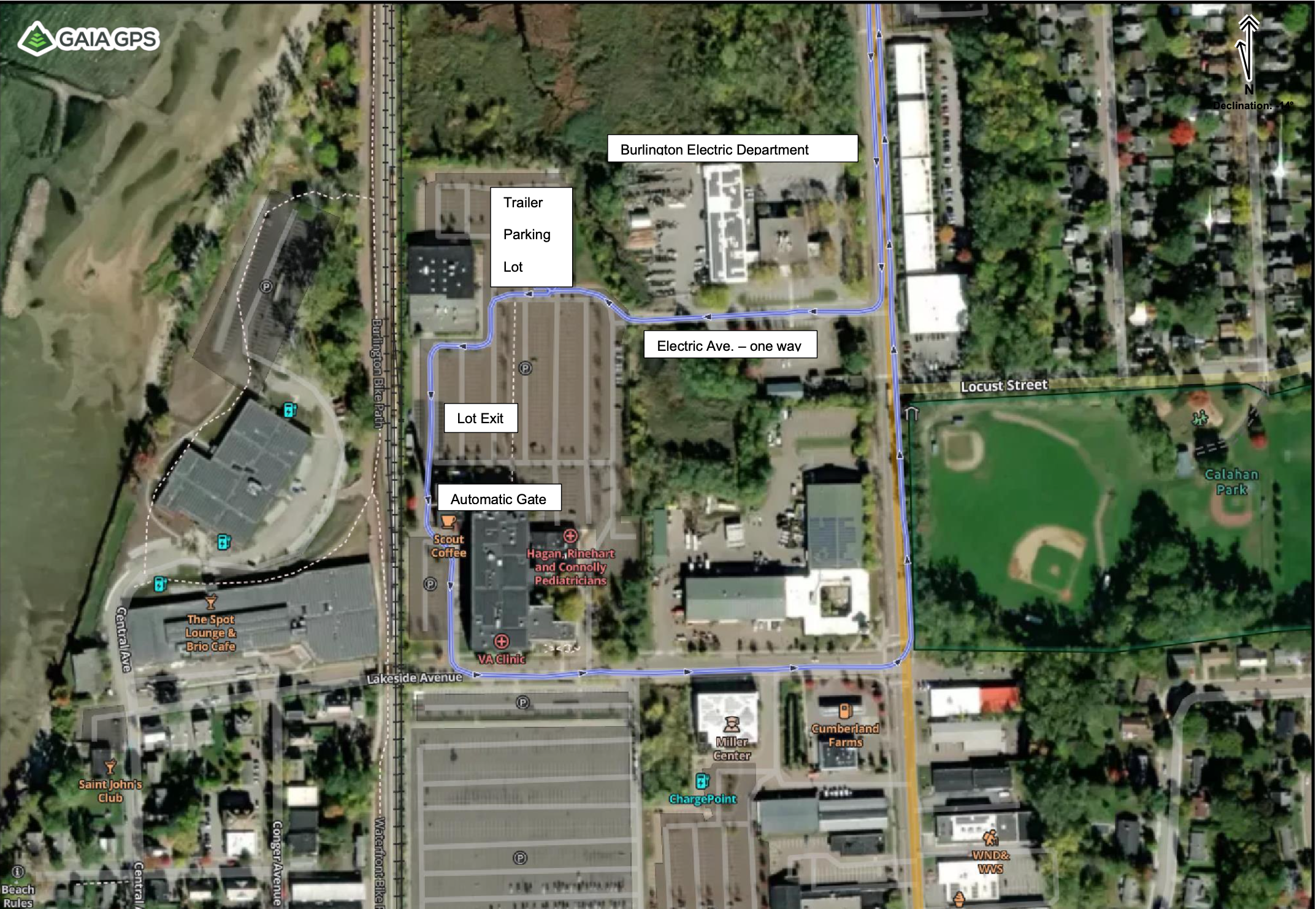
Below is a map of the waterfront Park showing the two boat launches; Coast Guard for the larger boats, and Perkins Pier for the smaller ones, (20’ and under). This map also gives basic directions to the trailer parking lot which is about 1 mile from the launch site. Following this map is a more detailed view of the lot for trailer parking. We are providing security in this lot from Thursday night through Saturday night from 5:00 PM to 8:00 AM.

The map below shows the one way route of Electric Ave off of Pine Street. There are a couple of speed bumps to go over, and the lot is the right. To exit the lot follow the one way route to the automatic gate, through to Lakeside Ave and back to Pine.
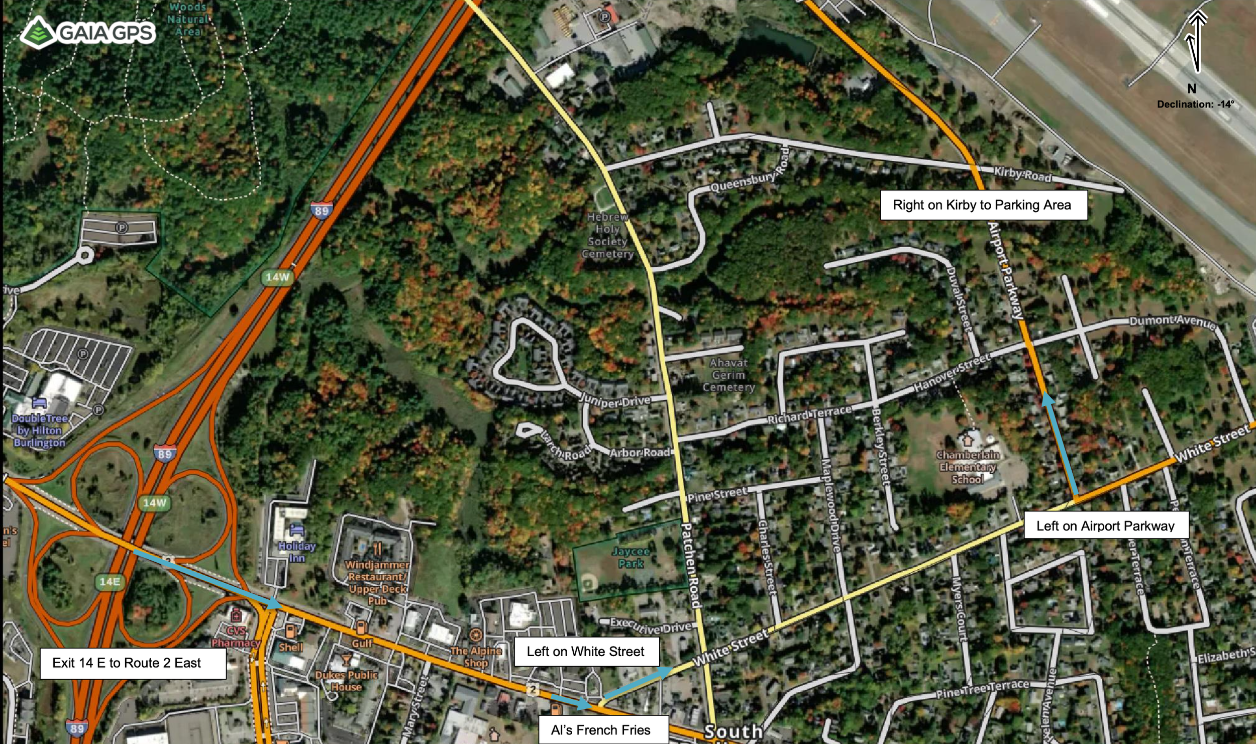
There is another area to park trailers in a quiet neighborhood on City owned property next to the Burlington Airport. It is open and in a park like setting, next to the Airport’s perimeter fence. Although there is no official on-site security there, the perimeter fence is regularly patrolled by Airport police from the airfield side, and they have committed to shining a light there at night to keep an eye on things. This is where the Northern and Southern cruise tow vehicles will be parked during the cruise, but the space is more than big enough to store all of the show trailers. It is further away from the show site though. Below is the map showing directions from Interstate 89 exit 14.